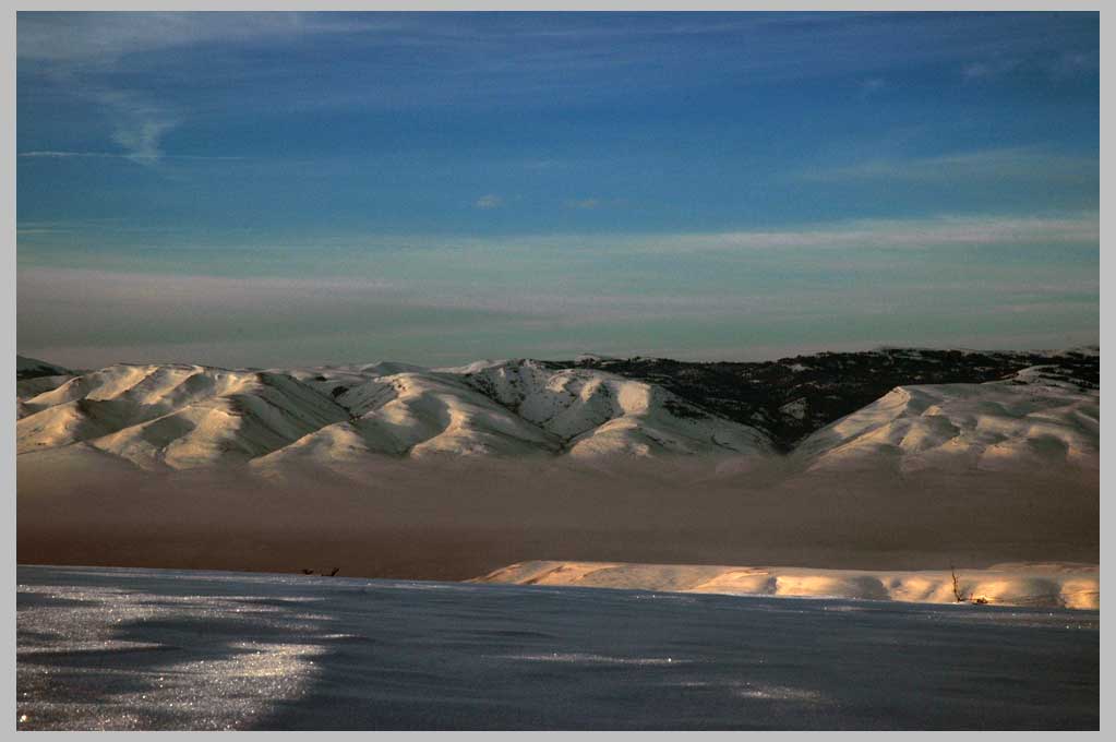
Eagle Valley Inversion, first light—the South Wallowas.
Eagle Valley Inversion, first light—the South Wallowas.
The mist below, although it may indeed be a beautiful sight to behold, is
full of particulate matter and others pollutants which essentially flow parallel
to the course of the Powder River, from Baker City (± 60 k west from here) and
the heavily-used Interstate 84. This is a common phenomenon in mountain areas.
The US, in my opinion, would do well to follow the Swiss example: when air
pollution levels rise above levels thought to endanger public health, the speed limit
is lowered to 80 k (50 miles per hour) using a real-time system of digital signs.
This creates, in my view healthy direct connection between your gas pedal
and the actual fact of environmental degradation, a fact which North American
car-culture seems to be determined at all costs to avoid. That is, until we make
the connection between our child's asthma, our grandmother's cough, and
perhaps one's own high blood pressure.
On the road in the Northwest of America.
| back to Picture/Poems:
Central
Display |
go to P/P Photoweek: Archive
|| or go to last week's PhotoWeek pages |
|
Map
|
TOC:
I-IV |
TOC:
V-VIII |
Image
Index
|
Index
| Text
Only
| Download
Page |
Newsletter
|
About
P/P |
About
Cliff
Crego |
Photograph by Cliff Crego © 2008 picture-poems.com
(created: II.25.2008)